Faced with the pressure to accelerate timelines and optimize costs, many infrastructure companies are shifting towards outsourcing Civil 3D Modeling service as a strategic solution. The outsourcing model not only helps cut down on operational and recruitment costs but also allows the civil team to focus on core work, prevents resource overload, and simultaneously enhances the accuracy and efficiency in each design phase.
What is the outsourcing Civil 3D Modeling service?
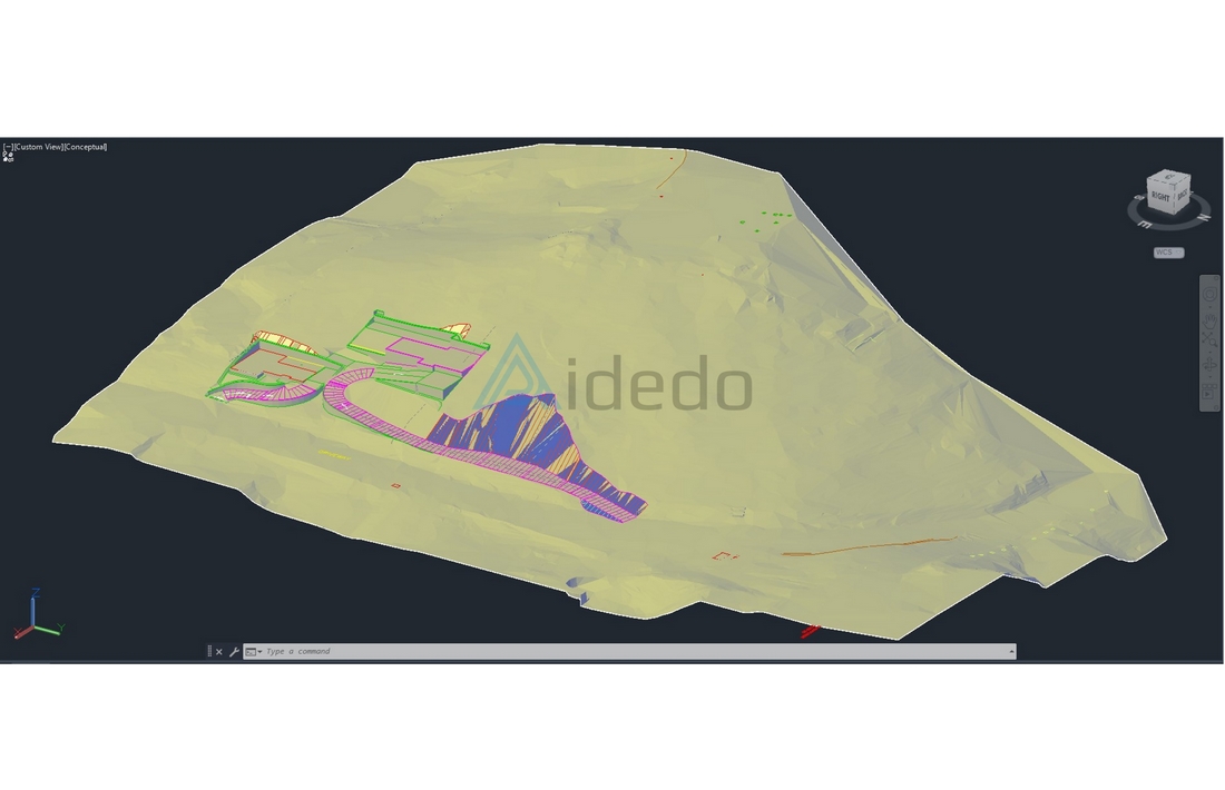
Outsourcing Civil 3D Modeling service is the service of developing a three-dimensional infrastructure model from survey and design data, with the aim of accurately representing the terrain and the project’s technical items. The model includes:
- Terrain Surface
- Grading/Earthwork
- Corridor alignments
- Stormwater drainage system
- Other related utility infrastructure
The accompanying technical elements include elevations, cross-sections, cut and fill volumes, coordinate systems and design annotations. These elements help users easily calculate, visualize, and approve the project, as well as serve the process of detailed design and construction implementation.
When should you use the Civil 3D Modeling service?
A company should choose a Civil 3D outsourcing service when it needs to process large survey data, handle complex terrain, quickly implement grading, drainage, and earthwork, and simultaneously address the shortage of Civil 3D engineers while ensuring the surface, corridor and pipe network models meet technical standards.
Based on the nature of the work, the following three groups of companies are frequent users of outsourced Civil 3D design and drafting:
- Civil Engineering Companies: They are often pressured to complete grading, drainage, cut & fill, and utility drawings within a short timeframe. Outsourced 3D modeling helps them quickly process the volume of drawings, sometimes in as little as 24 hours, ensuring accuracy, standardizing cut and fill volumes, and adhering to technical standards without the need to expand personnel or compromise document quality.
- Land Surveying Firms: The challenge lies in processing point cloud, contour, and field data to generate an accurate 3D terrain model, standardize the coordinate system, and minimize errors. Civil 3D design and drafting outsourcing services assist with data adjustment, creating a TIN surface that adheres to correct breaklines and boundaries, reducing post-processing time, enhancing reliability, and minimizing revisions before handover.
- Land Development Companies: They require speed and accuracy in their infrastructure models. Therefore, a Civil 3D outsourcing service helps quickly create subdivision layout drawings, road alignments, drainage, and earthwork, accurately calculate volumes, and prepare cost estimates. The 3D infrastructure modeling process helps to synchronize technical documentation, facilitating project approval, and enabling effective project progress control.
In addition, Survey & Mapping Firms, AEC Firms, along with project owners and real estate developers, also outsource Civil 3D Modeling services to convert survey data into accurate 3D terrain models, optimize the coordination between engineering and architecture within BIM, and quickly generate drawings for subdivision layout, roads, drainage, and earthwork, serving the purpose of accurate cost estimation, project approval, and on-schedule project implementation.
Standards and Regulations to reference for Civil 3D Modeling drawing acceptance
Civil Template of Company Standards
- Technical Drawings – General Principles of Presentation: Governs how line types, dimensions, and symbols are used in plan and profile views.
- DWG Export Standards – All Civil 3D models are exported in clean, layer-organized DWG files following industry standards.
- IFC – For projects requiring BIM compatibility, we can export terrain or pipe networks to IFC format.
United States (US) Standards
- AASHTO – American Association of State Highway and Transportation Officials: Followed for roadway, corridor, cross-section design.
- ALTA/NSPS Survey Standards – Base survey data and existing conditions modeled per these standards.
- MUTCD – Manual on Uniform Traffic Control Devices: Used for modeling traffic signs, markings, road geometries.
- State DOT Standards – We model per Department of Transportation standards (e.g., Caltrans, TxDOT, FDOT).
- SPCS (State Plane Coordinate System) – Used for geospatial accuracy in surface modeling and alignment layout.
- ASCE Standards – Referenced for utility design, stormwater, grading, and drainage compliance.
Australia Standards
- AS 1100 – Technical drawing standards for civil design sheets and profiles.
- AS/NZS 3500 – For modeling stormwater and drainage infrastructure.
- AHD (Australian Height Datum) – Applied in terrain elevation modeling and surface creation.
- GDA2020 – All Civil 3D models for Australian clients use correct coordinate datum.
- Local Council CAD Standards – We comply with city-level submission requirements for VIC, NSW, QLD, etc.
United Kingdom Standards
- Manual for Streets (MfS) and Design Manual for Roads and Bridges (DMRB) – Followed in road corridor and horizontal alignment modeling.
- BS 1192 / PAS 1192 – Applied in BIM-integrated Civil 3D workflows for site development.
- Ordnance Survey National Grid / OSTN15 – Used for all coordinate-based terrain or utility modeling.
- Sewerage Sector Guidance (SSG) – For drainage and utility modeling when applicable.
Canada Standards
- Canadian Design Standards (TAC Guidelines) – Used for roadway geometry and corridor modeling.
- NAD83 (CSRS) – Coordinate system applied in all terrain and surface models.
- CLS Guidelines – For federal land projects using Civil 3D survey base.
- City CAD Standards – We customize templates for local municipalities like Toronto, Vancouver, and Calgary.
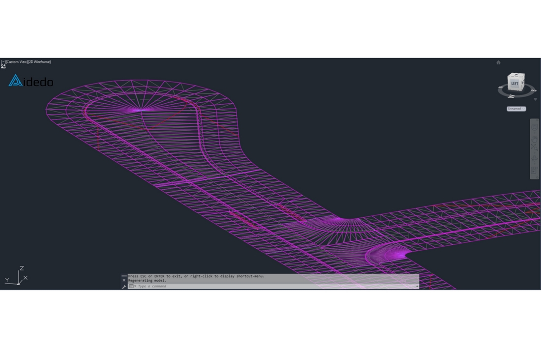
What is the role of Civil 3D design and drafting outsourcing services during the detailed design phase of a project?
3D Modeling is part of the detailed design process for a project owner’s (or developer’s) project. In this process, outsourcing providers like Aidedo primarily participate in the role of designing and completing the project model on the computer, along with proposing solutions for the Project Owner to choose from to optimize the design plan, specifically as follows:
1. Receive survey data
- Aidedo receives the project’s current status information from the client, checks the information, and requests supplementary details if needed.
- Receives design requirements for the project.
2. Data processing
- Aidedo classifies and checks the survey data before starting the design.
- Aidedo can provide consultation on necessary checklists and standards right from this stage.
3. 3D Infrastructure Model deployment (Aidedo’s Primary Involvement Phase)
- Aidedo receives the surveyed data, standardizes it according to the coordinate system, datum, and benchmark.
- Develops the model for terrain, grading (or earthwork), corridor, drainage system, technical infrastructure, etc.
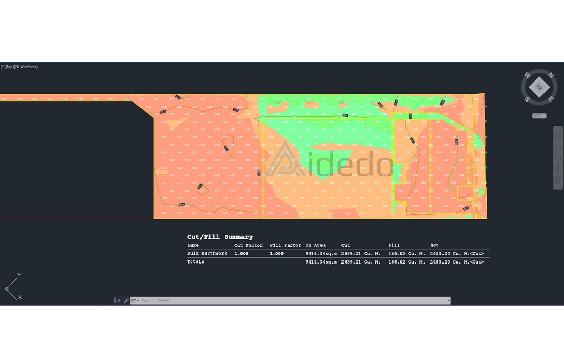
- Represents technical elements: elevations, cross-sections, cut and fill volumes, and construction zones.
4. Project lifecycle monitoring
- Once the complete 3D model is handed over from Aidedo, the client can use it to: Prepare detailed design drawings.
- Submit documents for construction permits or project approval.
- Proceed with construction implementation and progress management.
Aidedo always accompanies the project throughout its lifecycle, ready to accommodate all changes with maximum flexibility. Thanks to a dedicated team and a clear process, all adjustments are handled quickly and systematically, ensuring the project stays on track and achieves the highest efficiency.
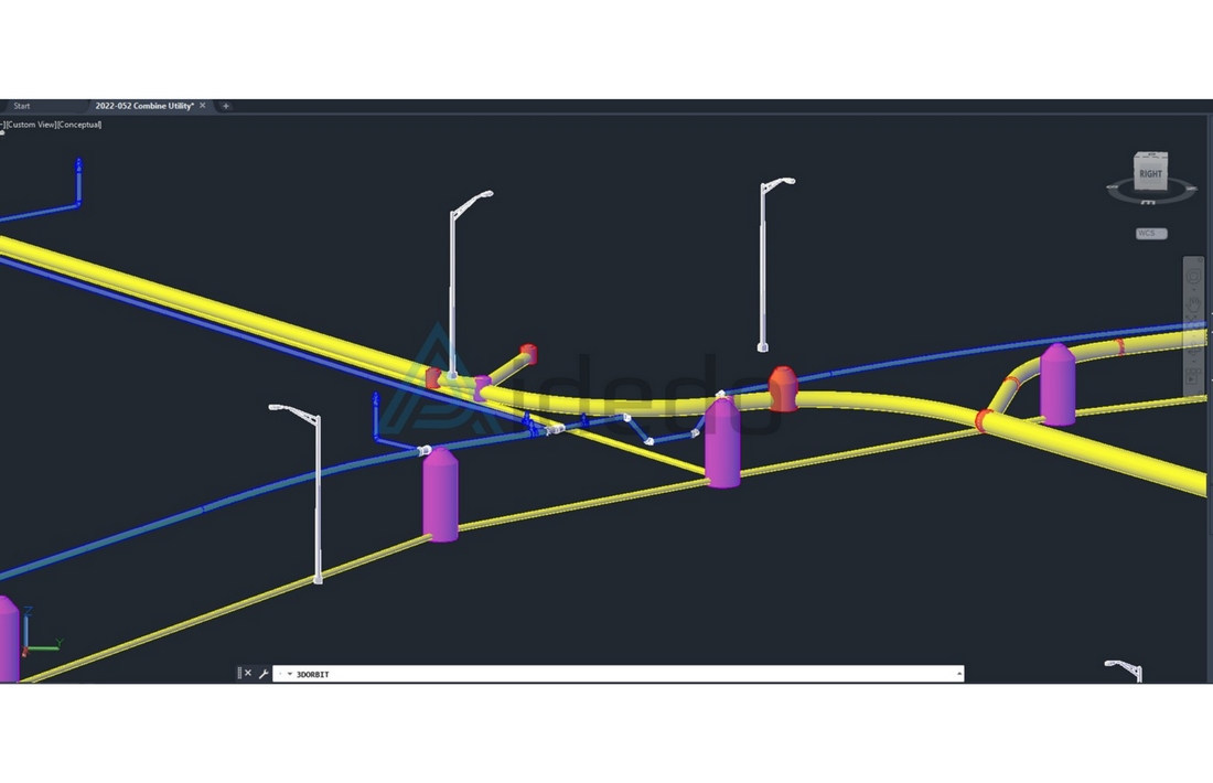
List of input data reviewed by the Outsourcing Civil 3D Modeling service
1.Survey Data
- Existing Condition Survey Drawings: .PDF, .DWG, or .DXF
- Point Data File: .CSV, .TXT (containing X, Y, Z coordinates)
- Point Cloud Data: .RCP, .LAS, .E57
- Contour Data or DEM, DSM, DTM (if available)
2. Planning files / Preliminary design drawings
- Subdivision Layout, Long/Cross Sections, Road Alignment (if available)
- Basic Alignment or Alignment (.xml, .csv, .pdf, etc.)
- Grading, Drainage Guidelines, or Design Constraints
3. Technical requirements & Drawing standards
- Local standards (e.g., AASHTO, Austroads, DMRB, City Standards)
- Drawing format template: layers, text styles, blocks, title blocks
- Coordinate system (datum), measurement providers (metric or imperial/feet), slope providers (%)
- Drawing output regulations: paper size, layout, symbols/notation, etc
4. General project information
- Project name, geographical location, type of work (road, subdivision, grading, etc.)
- Deadline, urgency requirement (or whether it is a rush requirement)
- Estimated workload, number of drawings/cross-sections required
- Purpose of Use: for construction, permit application, investment documentation, bidding, etc
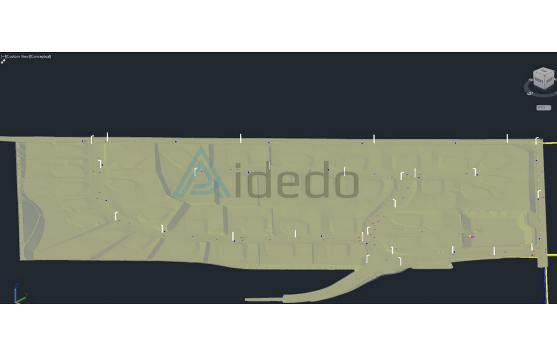
Detailed implementation process for outsourced Civil 3D drafting
After successfully completing the input data verification via the checklist above, Aidedo will proceed to Convert 2D to 3D Modeling according to the client’s required standard format, utilizing specialized engineering software such as InfraWorks, Civil 3D, Vehicle, and 12D to support the project drawing deployment process, specifically:
1. Receiving requirements and input data
- Receive project information from the client, including survey data (point cloud, coordinate elevations, field notes), existing condition drawings, or design sketches.
- Confirm the input data requirements for the grading model with the client.
2. Analysis and discussion
- Review input information and hold a general discussion with the client to clarify each requirement detail, such as: cross grade, 2:1 slope, road width or balanced cut/fill earthwork.
- Propose solutions or options following the project analysis process.
3. 3D Grading model development
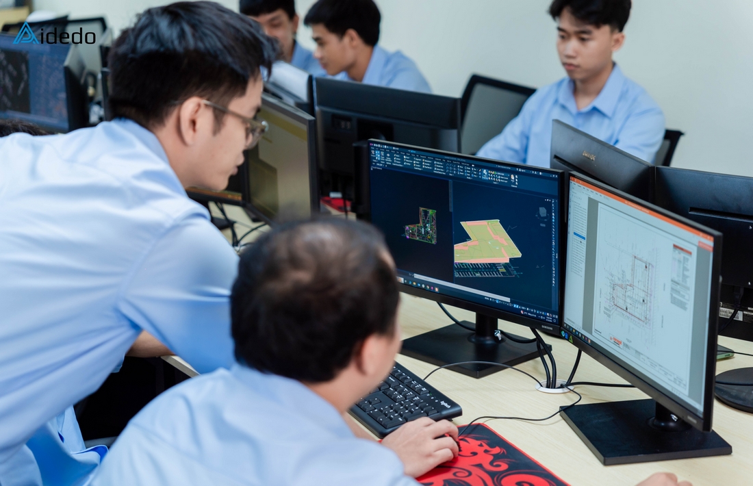
- Implement the work using Civil 3D or 12D software
- Work in detail with the profile, corridor, and feature lines of the Grading model
4. Check and adjustment
- Create check sections for the model to perform detailed checks on elevation, grade, and height of the retaining wall.
- Adjust the grading model to align with the construction method or to optimize project investment costs.
5. Deliverables handover
- Export the model and technical drawings according to the client’s required standard format.
- Provide volumes (or quantities), technical annotations/notes, and relevant documentation to be used for design, approval, or construction.
Aidedo’s brand positioning foundation in the Civil 3D Outsourcing service sector
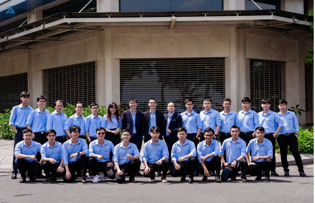
- More than 40 engineers specializing in 3D Modeling are trained for the US, AU, and other markets and are regularly given internal training to improve their expertise and update new developments in 3D Modeling from management levels.
- Successfully executed over 5,000 3D Modeling projects for residential, commercial, industrial, and Land Development project types
- The team of engineers is led by Aiden Tong – CEO & Founder of Aidedo, who studied and worked in California (USA) and has direct working experience with numerous clients from developed countries.
- Aidedo has been audited and recognized by ASCE (American Society of Civil Engineers) for its capability to help companies in construction and land surveying save up to 50% on costs.
- Aidedo’s engineering team is constantly striving to achieve a level of expertise equivalent to the PE (Professional Engineer) international practice certification in order to best serve the needs of clients worldwide.
- Flexibly support client needs to the maximum, for example: Support data conversion from 3D Modeling to required format, support editing 3D Modeling after feedback from management agencies and can create 3D Modeling from corridor and Feature line.
- Always maintain 3D Modeling services and client support updates.
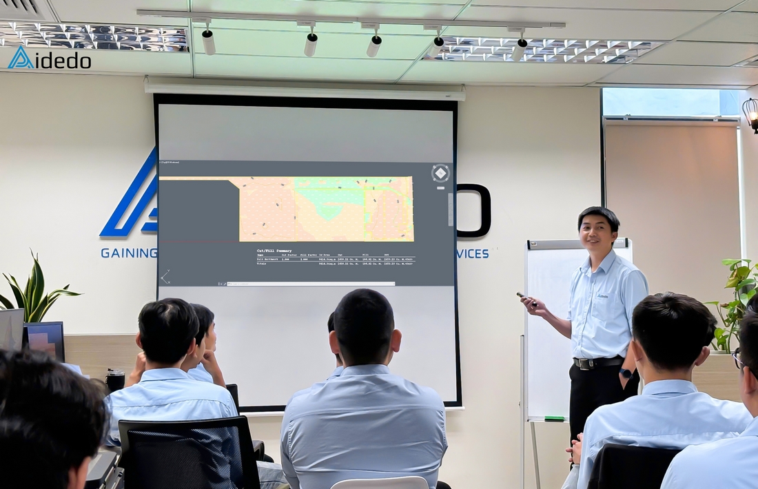
Advantages of partnering with Aidedo for Civil 3D Drafting services
Optimize operational costs by up to 50% thanks to outsourcing Civil 3D Modeling service at Aidedo
You don’t have to worry about recruitment costs, don’t need to spend time training new engineers, nor incur fixed expenses such as salaries, insurance, benefits, taxes, office space, or specialized technical equipment.
Aidedo provides comprehensive support in 3D Modeling development
Ensuring accuracy regarding project coordinates, boundary, checking soil type parameters, providing earthwork volume reports, and completing the site layout for earthworks documentation (or earthworks design layout), thereby enabling subsequent tasks.
Quality assurance/Quality control (QA/QC) process
We have a quality control process that we always implement across all 3D Modeling projects, demonstrated through the following work:
- Organizing work folders for components like site plan, existing surface, Alignment, Corridor, and Proposed surface.
- Method of labeling elevations and slopes for feature lines, which allows us to easily control the quality of our 3D Modeling.
Access to multiple sample works
Through sample works, clients can view the types of 3D Modeling we have completed. Additionally, we will inform the client of the specific software (Civil 3D or 12D) we used to complete the 3D Modeling. This also allows the client to confirm if the output model matches their current project requirements.
Rapid deployment by leveraging time zone differences
Aidedo always takes the initiative to complete 3D Modeling for clients as quickly as possible. During the 3D modeling process, should more specific requirements arise, we will collaborate with the client to propose solutions and finalize the completion time.
100% refund policy within 24 hours
Clients will not be charged if the deliverables fail to meet the committed standards. Should the 3D Modeling drawings contain technical errors or if handover is delayed due to Aidedo’s fault, we will issue a 100% refund within 24 hours.
Absolute confidentiality of project data
Clients are supported in converting data from 3D Modeling to the required format.
Developing internal tools for 3D Modeling projects based on frequently repeated task
FAQs about Outsourcing Civil 3D Modeling service at Aidedo
Absolutely, at Aidedo, we perform the full scope of both:
- 3D Existing Surface Modeling from survey data, point cloud, PDF, lidar data, etc
- 3D Proposed Design Modeling: Polyline, 3D polyline, Feature line, Corridor, 3D face, etc
We utilize Civil 3D extensively (or in-depth), ensuring a logical and precise connection between the existing conditions and the proposed design.
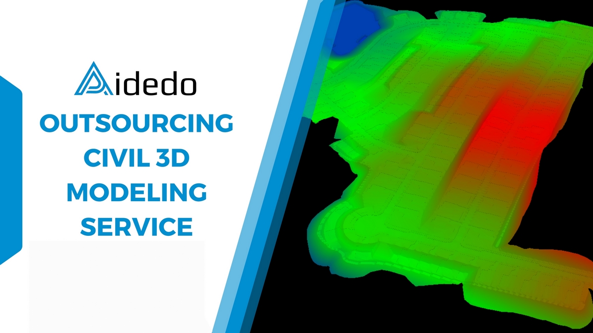
Yes. We can take-off quantities (Cut-Fill, Materials, etc.) directly from the Civil 3D model and export the volume report according to your custom template format: Excel report, PDF report, cut-fill heat map, and customized volume reports.
Yes. Aidedo utilizes 12D software to execute technical drawings, including:
- Creating 3D Modeling Alignment, Super Alignment, MTF, String, and Vertical Alignment.
- Supporting data import and export between formats such as 12da, 12daz, LandXML, DEMs, IFC, KML, and KMZ, ensuring compatibility with the client’s technical requirements and software.
Please send us a sample file or specific request, and Aidedo will review it and propose a suitable process.
In addition to the questions already answered, clients can visit the FAQs section to learn more about our working process, payment methods, and the service commitments Aidedo provides.
Client reviews about outsourcing Civil 3D Modeling service at Aidedo
Overall, the information above provides an overview of the outsourcing Civil 3D Modeling service at Aidedo. If you are interested in a partnership, please contact us via email at contact@aidedo.com or fill out the form below. Our team will respond and arrange a one-on-one online meeting within 1–2 hours, or no later than 12 hours from the time the request is received. In parallel, if you are interested in other civil engineering outsourcing services, please visit our Outsourcing Civil Engineering Services page for more details.

