STATUS/ COUNTRY: Illinois, USA
AREA: 103 ACRE
RESIDENT LOTS: 287
PROJECT SUMMARY:
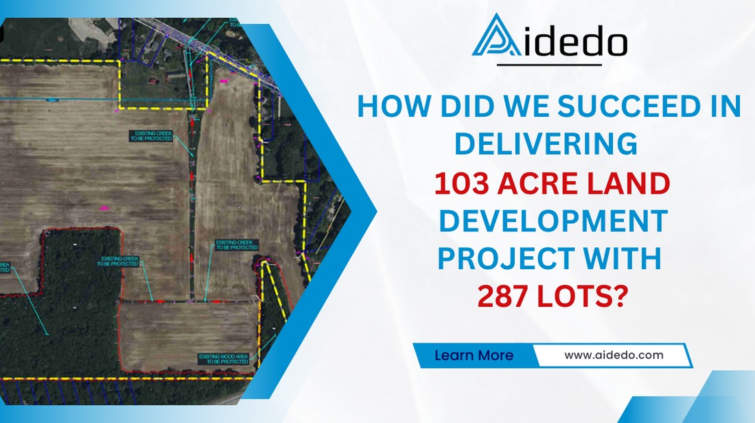
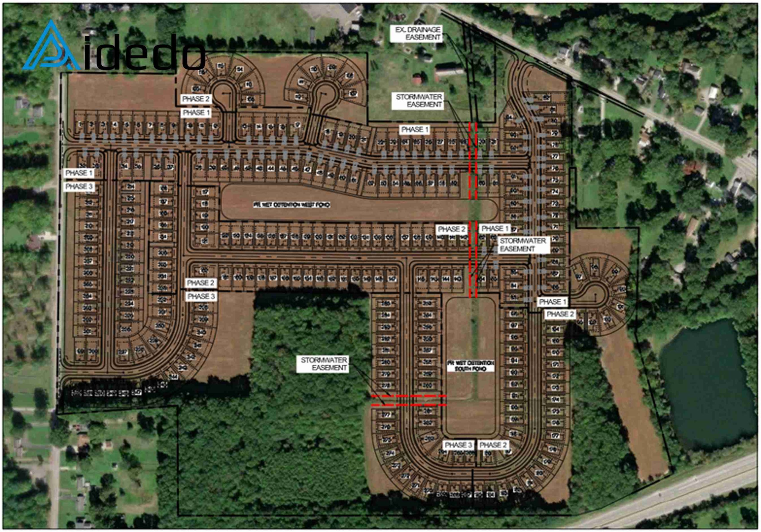
The 103-acre land development project is scheduled for completion in early 2022. It is divided into three phases:
- Phase 1 includes 96 lots and the West Pond.
- Phase 2 is designed with 108 lots.
- Phase 3 comprises 83 lots and the South Pond.
STEP 1: ANALYSIS OF EXISTING SITE CONDITIONS:
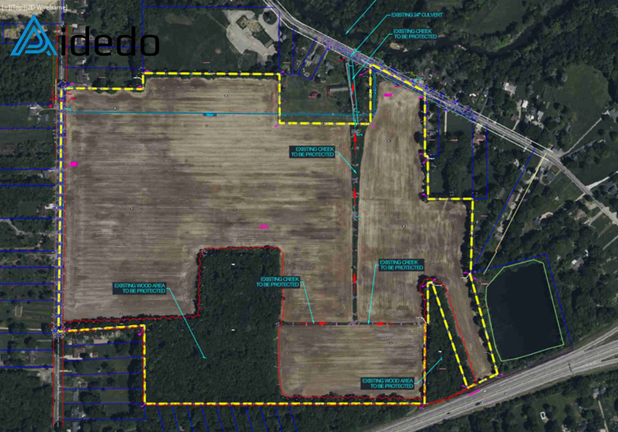
At the southern boundary of the site, there are existing wooded areas that need to be preserved in order to minimize disturbance to the natural environment.
Additionally, a drainage channel serving the upstream catchment area crosses the site from south to north.
This requires us to propose a solution that ensures the protection of the shared drainage corridor for the upstream flow.
STEP 2: PROPOSED SITE LAYOUT AND SOLUTIONS INCORPORATION INTO EXISTING CONDITIONS:
The proposed site layout has been developed, incorporating a 40-foot stormwater easement to convey runoff to the wet detention pond.
Rainwater is directed to the wet pond, where it is retained before being discharged to the existing river located at the northern boundary of the project site.
Read more: Grading and Drainage Plan Outsourcing Service
STEP 3: FINAL GRADING MODEL BY CORRIDOR AND FEATURE LINE
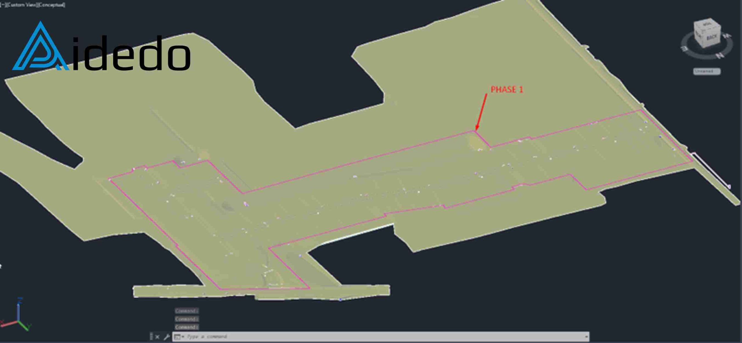
We have successfully completed the grading model for Phase 1, connecting internal roadways within the project to the existing roads.
The elevation of roads, curbs, swales, and pad levels has been finalized, with careful design of longitudinal and cross grade.
A maximum slope of 5% is maintained for driveways connecting from the road to private garages.
Swales are strategically placed around houses to collect stormwater and direct it to the project’s common drainage system.
STEP 4: CREATE UTILITIES SYSTEM MODEL BY PIPE NETWORK AND PRESSURE PIPES
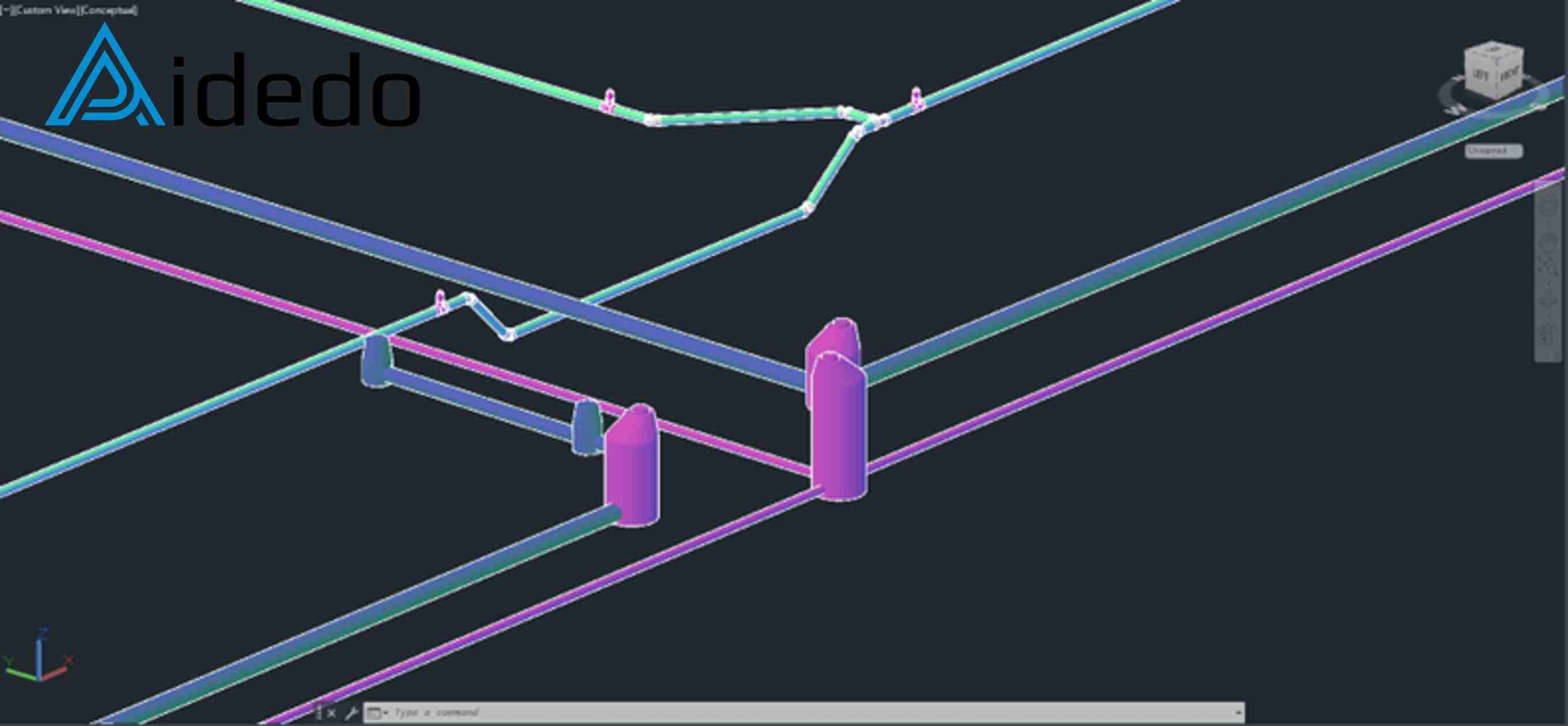
We have developed the stormwater, water supply, and wastewater modeling systems for the 103-acre land development project.
Accurate layout planning and elevation control from the early design stage have contributed significantly to the overall success for our client
especially at traffic intersections, where multiple utility systems intersect within a limited space.
Read more: Land Development Design Outsourcing Service
STEP 5: FINAL GRADING PLAN:
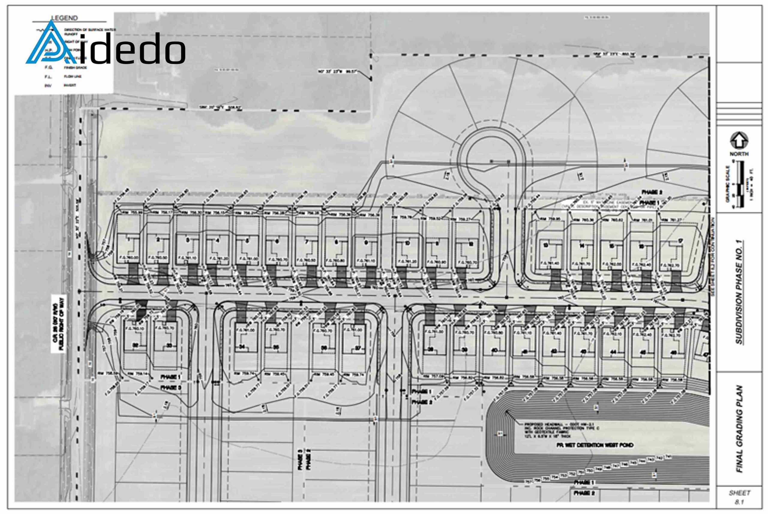
We present all design information and concepts clearly on each sheet and submit them to the client.
Here, we strictly follow the client’s standards for line styles, line weights, plot styles, and text styles.
We are always careful to double-check the accuracy of design elevations displayed on the sheets, as these reflect the dedication of each engineer ensuring that their work conveys complete and consistent information across the entire land development project.
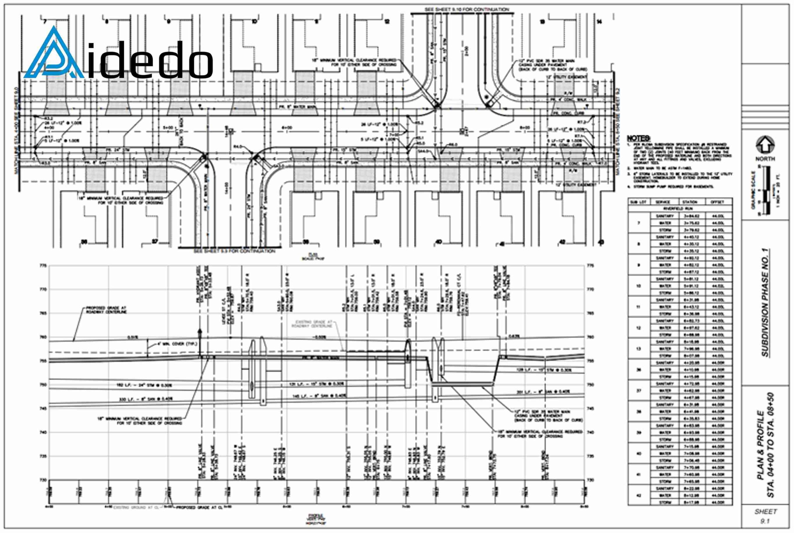
STEP 6: PLAN & PROFILE SHEETS:
A critical part of the project is presenting the plan and profile views on the sheets.
In our workflow, we include detailed annotations such as server information, stationing, and offsets.
Particularly, we highlight the minimum cover for water pipes, as well as the length and slope of the pipe network.
Read more: subdivision design outsourcing service
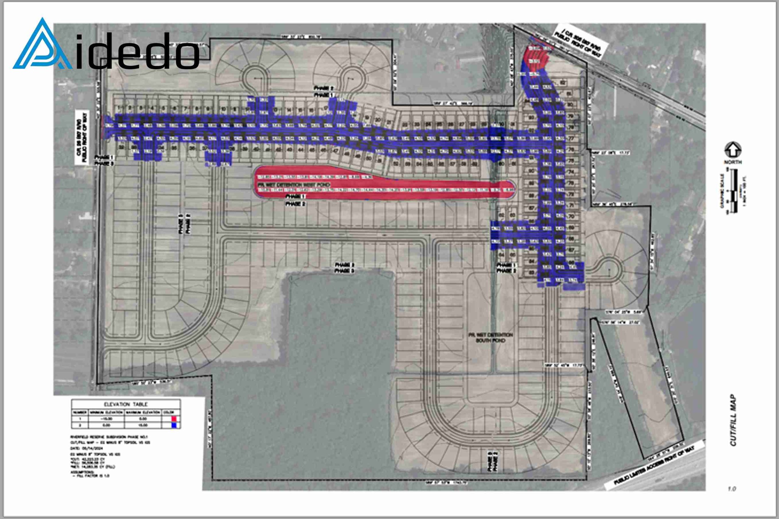
STEP 7: CREATE CUTFILL REPORT:
The Cut/Fill Map is one of the services we regularly provide to our clients.
It serves as a critical reference for all earthwork-related activities on the project.
In addition, we deliver accurate volume calculations tailored to each design phase, helping clients plan and allocate resources effectively.
Are you handling a large land development project and need expert support to ensure success?
At Aidedo, we specialize in delivering high-quality civil engineering and land development drafting services. With over 50 experienced engineers and thousands of successful projects completed, we help our clients reduce costs by up to 50% and accelerate project timelines by up to 2 times compared to industry standards.
Our team provided full support in grading, drainage, utilities, and subdivision layout for a 103-acre site with 287 lots in Ohio—completed with precision, efficiency, and full compliance to local standards.
If you’re looking for a reliable outsourcing partner who can help you achieve similar results:
Please contact us via email at contact@aidedo.com or Fill out the form below. Our team will respond within 12 hours. We also offer a free trial, so you can evaluate our quality and turnaround time with zero risk.
Let Aidedo become your trusted extension for faster delivery, lower costs, and long-term success.

