- Have you ever tried outsourcing contour and detail survey drafting services (Feature and level survey) but spent hours correcting drawings because the partner did not understand the technical nature, misused layers, used the wrong scale or did not comply with your company’s specific file format, symbol system, and drawing standards?
- Do you have field survey data consisting of thousands of coordinate and elevation points but cannot complete it on schedule because your internal team lacks CAD engineers or the current team is overloaded with multiple projects simultaneously?
- Are you in need of contour and detail survey drafting services to quickly convert all field survey data into detailed, technically compliant topographic drawings, ensuring output quality to serve as a basis for infrastructure design or to complete legal documents but do not want to invest more in specialized technical software and recruit engineers to incur fixed monthly costs?
If you are facing the above problems, contour and detail survey drafting services act as an effective solution to help land survey companies fully address issues related to human resources, costs, and implementation efficiency. This service not only helps reduce pressure on the in-house team but also ensures the quality of drawings according to the correct forms, technical standards and strict deadlines of each project.
With high flexibility, easy integration into internal workflows, and the ability to accurately handle the specific requirements of each client, feature and level survey (another name for contour and detail survey drafting services) is being trusted and chosen by many land surveying in Australia as an essential part of their operational strategy.
Note:
- In the field of land survey in Australia, the terms “Contour and Detail Survey” and “Feature and Level Survey” are commonly used interchangeably. Most service providers consider these two terms to refer to the same type of survey that is, a survey of both natural and man-made ground features combined with elevation data collection to support design, construction and permit applications.
- In this article, to ensure the content is presented in a more flexible and accessible manner, we will alternate between the terms “Contour and Detail Survey” and “Feature and Level Survey” without altering the fundamental nature of the service being described. This consistency is intended to avoid confusion and reflect the commonly accepted terminology in the Australian surveying industry.
Who is contour and detail survey drafting services suitable for?
For land survey companies in markets with high technical requirements like in Australia implementing contour and detail survey drafting services is not merely about creating drawings, it’s a foundational intermediate step in the survey and design process. When field data is ready but the in-house team lacks the capacity or cannot handle the overwhelming workload, they need a solution to convert raw data into consistent contour and detail drawings that adhere to internal technical formats and are ready for integration into the next design phase.
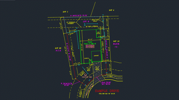
These companies usually possess a complete set of data, from PNEZD files, point clouds, and benchmark systems (horizontal and vertical controls) to existing features like fences, trees, drainage systems, or internal roads. However, recreating a topographical drawing cannot be entrusted to someone who is merely proficient in software operation. It demands deep technical thinking, a thorough understanding of terrain structure, how to analyze elevations, represent contour lines, and use the correct layering system according to each company’s technical standards. If the person performing the task doesn’t grasp the representation logic or understand the technical context, the drawing will easily have incorrect scales, won’t match the template system, and could even delay the entire subsequent design progress.
That’s also why many land survey companies have felt frustrated when outsourcing feature and level survey services. Receiving a drawing with incorrect layers, non-standard presentation, or having to spend hours manually checking and correcting it not only wastes time but also impacts operational reliability.
Companies that have experienced such situations are considered the most potential client group for contour and detail survey drafting services, with the aim of replacing their current partners. They don’t just need a mere supplier; they need a partner with sufficient technical understanding to do it right the first time, capable of delivering complete files according to the correct standards without multiple rounds of instructions or revisions. These are companies seeking a highly technical, flexible in collaboration, and strong rapid response solution.
Contour and detail survey drafting services are also particularly suitable for companies operating with lean engineering teams, prioritizing the focus of their resources on core tasks and technical inspection. Meanwhile, standardized tasks like drafting detailed topographic drawings can be transferred to a highly specialized, reliable provider that understands the technical standards of each market. For them, outsourcing isn’t about cost savings, but about maintaining stable operational rhythm while ensuring project timelines and technical output quality.
Additionally, there’s another group of clients who need contour and detail survey drafting services: land survey companies that don’t want to hire additional in-house engineers just to handle seasonal workloads. Expanding internal staff means costs for specialized software, benefits, insurance, and training time, while projects don’t always occur continuously. Outsourcing feature and level survey services helps them maintain a lean operation, optimize costs, and still ensure both deadlines and technical quality.
With all these benefits, contour and detail survey drafting services are truly suitable for land survey companies that are looking for an alternative outsourcing provider to replace their current partner. They’re also ideal for those who need to maintain high operational efficiency without expanding their workforce, want to preserve their budget while upholding technical standards, and aim to accelerate projects without compromising the accuracy of each drawing.
Read more: topographic survey drafting outsourcing service
What are the outstanding benefits when land survey companies use contour and detail survey drafting service?
When utilizing contour and detail survey drafting services, land survey companies don’t just find an outsourcing solution for their drawings, you also solve many strategic challenges within their technical operational process. This service is not merely about redrafting field survey data, but a technical process demanding a deep understanding of terrain, elevation representation, and the standardization of technical information in CAD drawings elements that play a foundational role for the entire subsequent design phase.
The first benefit comes from ensuring technical accuracy in every drawing, allowing you to focus on more critical tasks and optimize the time spent checking final outputs. Contour and detail drawings don’t just depict the existing ground plan, you also describe elevations through contour lines, linked to PNEZD point data, point clouds, or GPS survey. If the drafter doesn’t understand how to analyze elevations, incorrectly identifies terrain elevations, represents contour lines illogically, or uses the wrong layers, the consequence is that the entire subsequent infrastructure design can be misaligned, leading to errors in grading, drainage, and structural positioning. By outsourcing to a reputable team specialized in feature and level survey services, companies can ensure that data is represented accurately, according to their internal layering system, and consistent with field technical logic, significantly reducing the risk of technical errors in later stages.
Secondly, companies effectively save time and internal resources while still maintaining quality control. In reality, the workload in the land survey industry isn’t consistent week-to-week or month-to-month. At times, a company might need to process survey data for hundreds of hectares of land with tens of thousands of elevation points, but they can’t quickly hire engineers to draft drawings in just a few days. On the other hand, if they expand in-house staff, companies must invest in licensed CAD software, training costs, insurance, and benefits, while the workload is seasonal. Using contour and detail survey drafting services allows companies to rapidly handle periods of increased demand without incurring additional fixed costs.
Thirdly, the standardization of drawings to internal formats is a distinctive value that few outsourcing providers can meet. With a technically knowledgeable partner, drawings are drafted exactly according to the CAD or Civil 3D templates that the company uses. From file naming conventions, layer structures, linetype formats, to technical notes, everything adheres to internal standards, helping the engineering team avoid spending extra time on revisions or integrating drawings into their current workflow. That’s why professional land survey companies often highly value feature and level survey services not just for drawing quality, but also for the “ready-to-use” nature of the output.
Beyond technical factors, this service also helps companies maintain project timelines and operational stability. With an external team ready to take on work at any time, companies won’t be entirely dependent on internal capacity. In cases where project deadlines are tight or clients require urgent drawing submissions, companies can fully expand their workload by collaborating with an outsourcing partner while ensuring deadlines are met and quality remains consistent.
Finally, contour and detail survey drafting services provide companies with financial flexibility and risk management. Instead of long-term investments for uneven work phases, companies only pay for specific work packages based on actual needs, avoiding unnecessary fixed costs. In today’s volatile market, optimizing costs and maintaining flexible operations are crucial especially for companies looking to grow rapidly while still controlling quality.
Read more: final survey drafting outsourcing service
Aidedo, The reliable partner you’re looking for in contour and detail survey drafting services
Many land survey companies have turned to contour and detail survey drafting services as a solution to speed up progress and reduce pressure on their in-house teams. However, in practice, quite a few companies have found themselves in awkward situations: the received drawings didn’t meet standards, layers were incorrect, scales were inconsistent, contour lines misrepresented terrain logic, or the layout was unprofessional. These experiences led to wasted time correcting, disrupted the design process, and gradually eroded their trust in the true effectiveness of outsourcing.
That’s precisely why clients often notice the difference right from the start when partnering with Aidedo. We don’t just meticulously and carefully deliver contour and detail survey drafting services; we approach each project as an extended part of the client’s in-house team. From understanding the input data and determining the appropriate method for representing contour lines for specific terrain types, to processing drawings on the Civil 3D or 12D Model platform according to existing technical formats every process is carried out by Aidedo with a deep understanding and tailored refinement for each individual client.
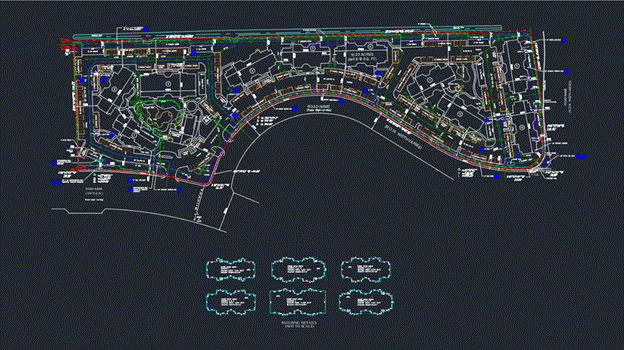
What creates Aidedo’s different capability doesn’t just come from drawing processing skills, but from real-combat experience in deploying feature and level survey service for many demanding technical markets like in Australia. In Australia, Aidedo has directly participated in performing and completing many Feature and Level Survey Drafting projects for states like: Queensland, Victoria, New South Wales, South Australia, Western Australia, Tasmania,… with diverse workload and complex technical requirements.
We have skillfully processed many different data formats from PNEZD, point cloud, GPS survey data to integrated LiDAR files. Even if clients use any system: layer, linetype, symbols, or naming convention, Aidedo thoroughly understands and ensures drawings comply precisely with each distinct standard according to each company, each state, and each project. The deep understanding about technical standards in Australia, along with fast adaptability with many survey methods and data formats, is exactly why partners in Australia continue to trust and choose Aidedo as a reliable and long-term drawing outsourcing partner.
When clients send us data, we clarify their needs and requirements to ensure the work is done exactly as desired. We’re familiar with the common technical formats companies use. With contour and detail survey drafting services and our other offerings, getting the format right, using the correct template, adhering to terrain logic, and ensuring 100% compatibility with the client’s internal software isn’t a bonus, it’s a default requirement Aidedo always commits to meet.
Beyond technical expertise, Aidedo also delivers another crucial value: freeing clients from unnecessary fixed cost pressures. Expanding an in-house engineering team to handle detailed contour drawings often comes with various additional expenses like monthly salaries, insurance, training costs, and maintaining specialized software such as AutoCAD, Civil 3D or 12D Model. Meanwhile, the workload often fluctuates some months are peak, while others are almost entirely empty, or the internal team is already stretched thin with too much work. This instability forces companies to constantly weigh long-term investment against the risk of wasted resources.
Aidedo provides a complete solution to this problem. When you use feature and level survey services at Aidedo, you only pay for the actual work completed. There’s no need to worry about software, no need to hire additional staff, no burden of operational management, or starting training from scratch. All drawings are delivered according to technical standards, on schedule, and are ready for use as if they were drafted by your own internal team.
Read more: plot plan survey drafting service
Why choose Aidedo over other providers?
When considering outsourcing contour and detail survey drafting services, many land survey companies understand that low price is no longer the top priority. What they truly need is a partner with strong professional capabilities, who understands international technical standards, collaborates effectively, and above all, helps the company save on fixed costs while maintaining the highest quality of drawings. Aidedo not only meets these requirements but also commits to exceeding expectations with a clear, fair and transparent partnership policy.

1. Optimize operating costs without sacrificing output quality
When working with Aidedo, clients don’t need to invest in additional specialized licensed software like Civil 3D, Carlson, 12D Model, Infraworks, HydroCAD, or Vehicle Tracking. All of these are fully equipped at Aidedo, with a team of engineers who have been extensively trained and are proficient in using these platforms.
Furthermore, instead of expanding an in-house engineering team, a costly and risky decision, especially in developed markets like Australia clients can leverage Aidedo’s flexible payment model.
There’s no need to worry about recruitment costs, no time lost training new engineers, and no incurring fixed expenses like salaries, insurance, benefits, taxes, office space, or specialized technical equipment.
All of this is integrated into Aidedo’s contour and detail survey drafting services model, where you only pay for the actual workload, but receive technical value equivalent to or exceeding that of an in-house team.
2. Fast deployment speed by taking advantage of time zone differences
Aidedo’s office is located in Ho Chi Minh City, GMT+7, which means a time difference of only 1 – 3 hours compared to Australia. This provides a significant advantage for clients. Project will be completed turnaround time within 24 hours
For example, if a client on AEST (GMT+10) sends a request at 5 PM, it is just 2 PM in Vietnam, and the Aidedo team is already on it. By the time the client starts the next workday, the drawings are completed and ready for hand-over.
We don’t just work fast; we also ensure that every detail survey drafting service drawing is processed according to the correct technical sequence and undergoes a two-layer review before delivery. This helps clients shorten their internal review time and accelerate overall project progress.
3. Proven on-the-ground capabilities
As of early 2025, Aidedo has:
- Successfully executed over 10,000 international projects.
- Served 100+ loyal clients in the US, Australia, Canada, Scotland, Ireland, and various other countries.
- Employed 50+ full-time engineers with deep expertise in topography, surveying, and infrastructure engineering.
- Operated out of 3 offices in Ho Chi Minh City, with plans for expansion to serve clients globally.
These aren’t just numbers, they’re proof of our real-world capabilities, structured processes, and long-term commitment to partnering with clients in any market
4. Clear collaboration process – unified technical standards – correct standard form
Every contour and detail survey drafting services project is executed according to each company’s specific form templates, layering systems, and technical formats. From file naming conventions and technical scales to presentation notes, everything is synchronized precisely with the standards the client currently uses internally.
The Aidedo team doesn’t need to be guided from scratch, we already have experience implementing common technical standards in many countries and are capable of quickly adapting to the unique standards of individual companies.
5. Absolute project data security
All data is processed within a closed internal system with strict access control, synchronized via a secure cloud platform, and access is limited by project. Aidedo rigorously adheres to Non-Disclosure Agreements (NDAs), committing not to share any client data in any form whatsoever.
6. 100% refund money within 24 hours
Clients will not be required to pay if the product does not meet the committed standards. In the event that contour and detail survey drafting drawings have technical errors or are delivered late due to Aidedo’s fault, we will provide a 100% refund within 24 hours. This is more than just a policy; it’s a testament to the responsibility and quality standards Aidedo upholds in every drawing.
Read more: detail survey drafting outsourcing service for australia
How does Aidedo perform contour and detail survey drafting services?
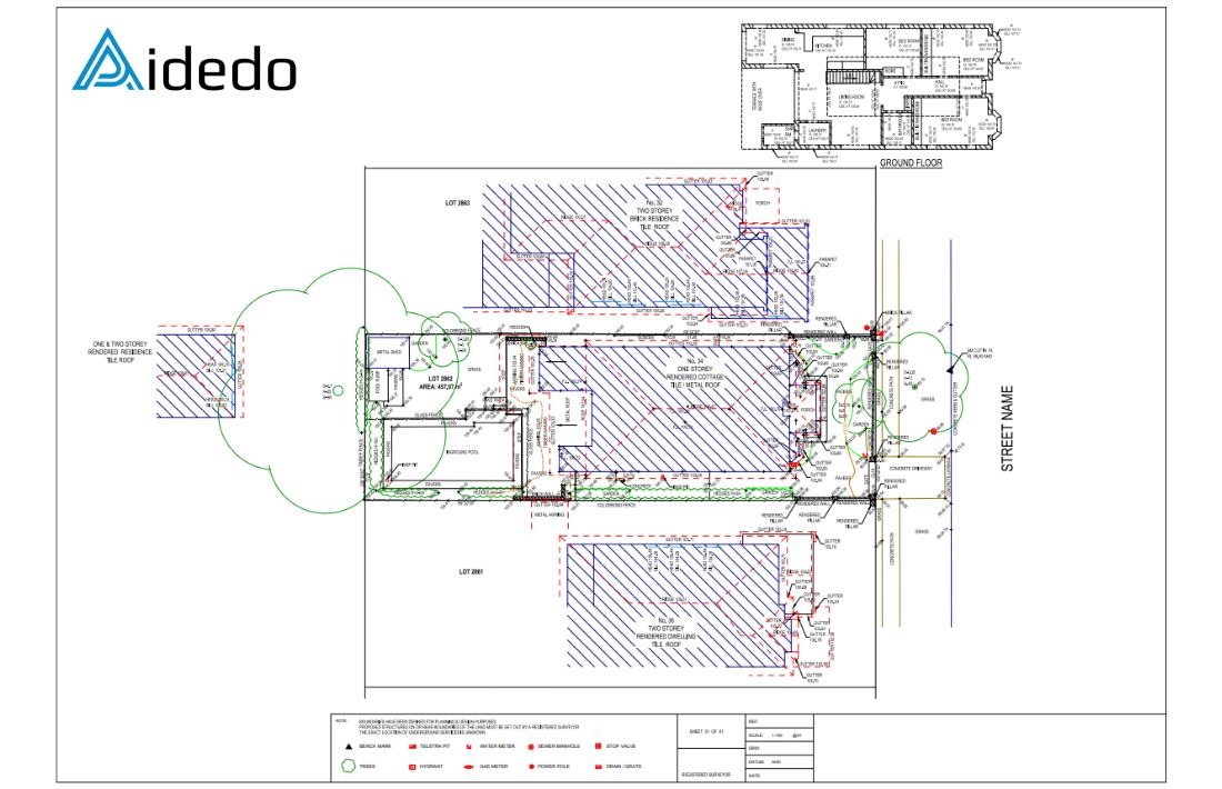
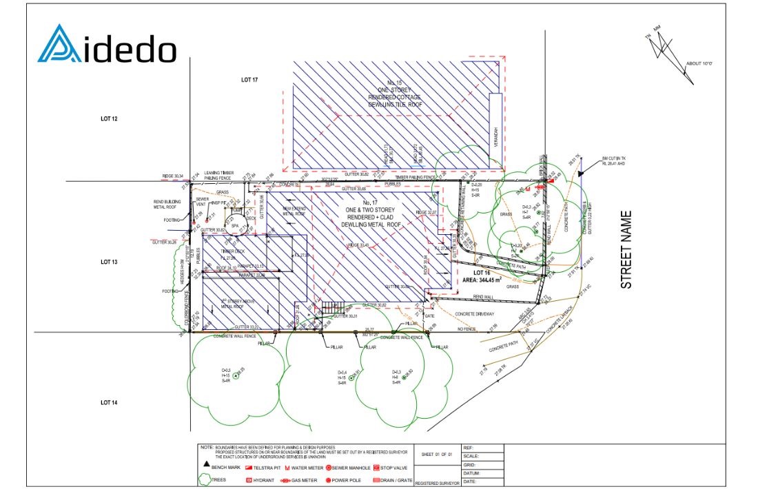
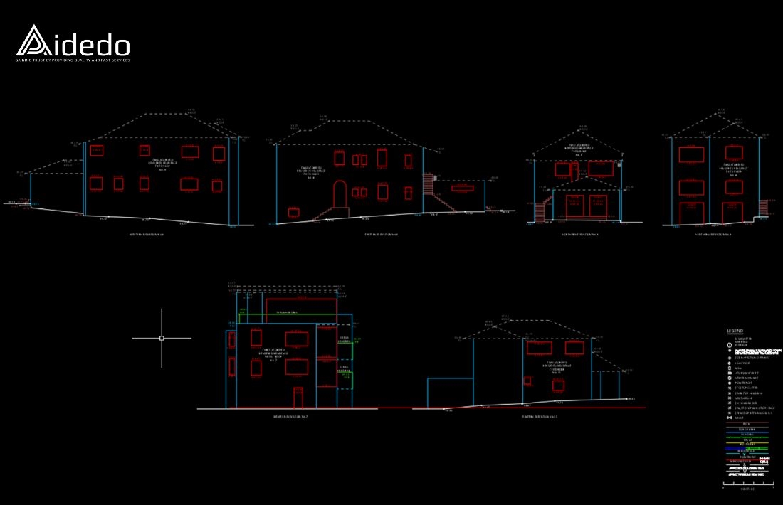
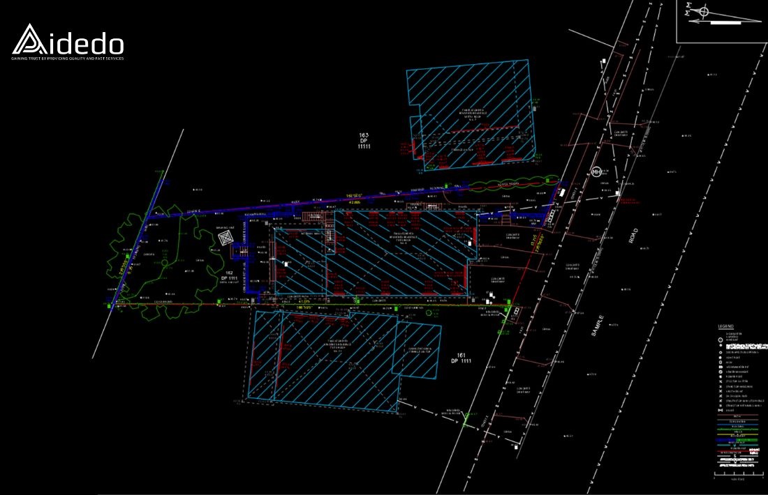
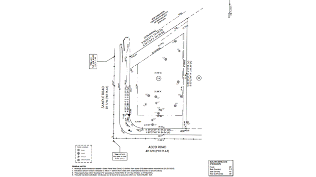
What is a detail and contour survey?
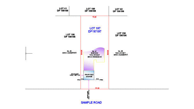
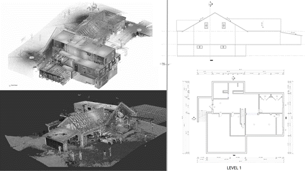
A detail and contour survey is a type of drawing used to identify and locate all the physical features on a piece of land. This includes both natural and man-made elements.
- Natural features may include vegetation, rocks, trees, stumps, and other landscape elements.
- Man-made structures include buildings, walls, driveways, fences, utilities, and other constructed features.
This type of survey is a standard requirement throughout Australia, especially in New South Wales (NSW), and is usually required before any new construction, renovation, or subdivision project begins.
Purposes of a contour and detail survey:
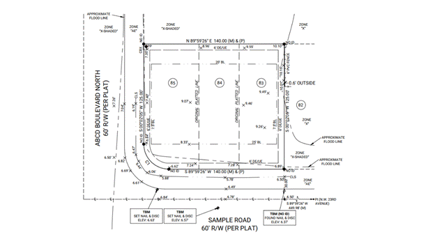
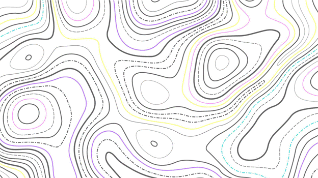
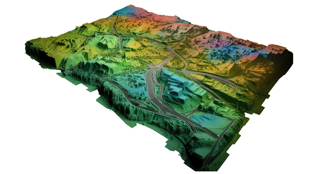
Contour Mapping: This process entails charting imaginary lines known as contour lines that link locations with the same elevation. These lines translate the terrain’s elevation, slopes, and landform into a visual format on a flat map, offering a 3D-like understanding of the landscape. Such interpretation is essential for identifying water drainage patterns, flood-prone zones, and overall terrain conditions, particularly in the design of stabilizing elements like retaining walls.
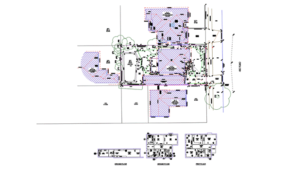
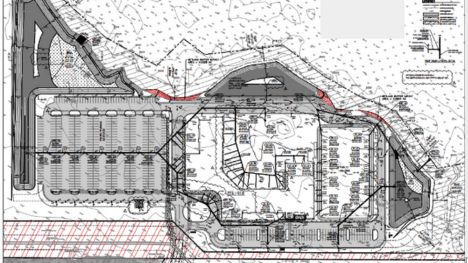
Detail Collection: Beyond just topography, a detail survey records both natural elements (e.g., water features, vegetation, and boulders) and human-made structures (like buildings, utility lines, and fences) present within the area. Gathering this full scope of site information is fundamental for effective planning and development, ensuring that any proposed construction respects and integrates with the current land features and infrastructure.
Steps to complete a detail and contour survey project:
Step 1: Review the input data provided by the client
Before starting the project, we need to check whether the data provided by the client is complete. We also need to understand the client’s requirements, identify the site location, and clarify the intended purpose of the survey.
Step 2: Import survey data into Civil 3D
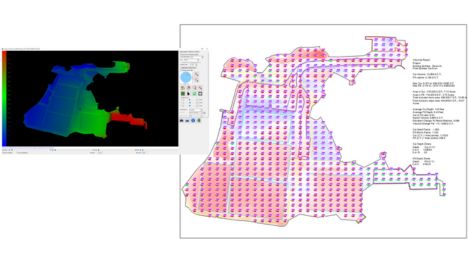
After the data has been imported, it is important to check that the correct coordinate system is being used. This includes verifying:
- The horizontal datum (e.g., GDA2020, MGA Zone 56) matches the project requirements.
- The vertical datum (e.g., AHD) is correctly applied to all elevation data.
- The providers are consistent throughout the dataset.
- The base point or benchmark used for positioning is correct and aligns with the project’s control points.
Step 3: Data processing and drafting
Use the point descriptions, site photos, and field notes to accurately complete the linework. Apply survey codes, layers, and symbology in accordance with client or council standards, and create a TIN surface model and contour lines.
Step 4: Quality control and verification
Cross-check data accuracy, completeness and consistency.
Step 5: Final deliverables
Deliver the required survey outputs in both PDF and DWG formats.
Detail Survey Drafting Sample Video
Read more: how to complete the detail and contour survey for a client in australia
Pricing policy for contour and detail survey drafting service at Aidedo
At Aidedo, our contour and detail survey drafting service, as well as other technical services, operate under two clear and transparent pricing models to flexibly meet the actual needs of our clients:
1. Hourly rate model
You only pay for the exact work performed, no more, no less. Importantly, Aidedo provides a dedicated client portal for you to monitor progress, execution time, and all project reports. This way, you always have control over the workload and budget efficiency. This model is ideal for projects that are expanding, changing scope, or require flexibility in implementation.
2. Fixed-Price model by item
If you need a precise cost estimate upfront for easier approval or budget management, the fixed-price model is the optimal choice. The Aidedo team will thoroughly analyze your requirements and send you a clear proposal for costs and the implementation roadmap, giving you peace of mind throughout the project execution.
No matter which pricing model you choose, Aidedo guarantees that you won’t be charged if we fail to meet the agreed deadline or project requirements. Furthermore, we offer the first project completely free trial, so you can evaluate our capabilities before moving forward.
Want to know exactly which pricing range your project falls into? Please send your request to contact@aidedo.com or fill out the contact form below. Our team will respond promptly within 1–2 hours, and no later than 12 hours, with a detailed, transparent quotation free of any hidden costs during execution.
Client feedback
Other services Aidedo provides
In addition to drafting contour and detail survey drawings, Aidedo also provides many other land survey drafting services to meet all of our clients’ surveying needs, such as:
TOPOGRAPHIC SURVEY
ALTA SURVEY
TREE SURVEY
BOUNDARY SURVEY
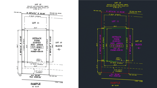
SETBACK SURVEY

FINAL SURVEY
CONTOURS PLAN
PLOT PLAN
DETAIL/INTERNAL SURVEY
SET OUT/PEG OUT SURVEY
3D SURVEY MODELING
POINT CLOUD TO FLOOR PLAN, ELEVATIONS
AS-BUILT SURFACE 3D MODEL
GRADING TAKEOFF USING CARLSON SOFTWARE
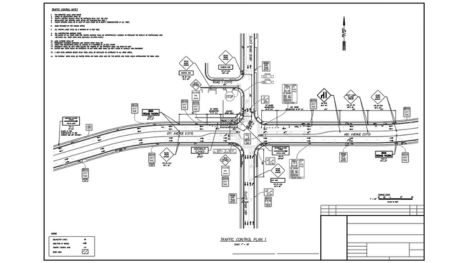
TRAFFIC CONTROL PLAN
How to partner with Aidedo
Aidedo believes that a clear, flexible, and convenient process is the foundation for sustainable collaboration. We’ve streamlined our process to just three main steps:
Step 1: Submit your request
The first step is to submit your request. You can contact us via email at contact@aidedo.com or fill out the online form below the article. Providing full details upfront will help the Aidedo team accurately grasp your needs and direction, allowing us to quickly propose a suitable solution.
Step 2: In-depth online discussion
After receiving your information, Aidedo will proactively schedule an online discussion via Google Meet, Zoom, Microsoft Teams, or any platform you prefer. This discussion aims to clarify the scope of work, estimated budget, collaboration methods, and specific implementation steps. We’ll also showcase similar projects we’ve completed, answer any related questions, and help you better understand Aidedo’s capabilities. This is an opportunity for both parties to connect and discuss before officially partnering, demonstrating professionalism and long-term goodwill.
Step 3: Utilize a free trial
Once both parties reach an agreement, Aidedo will kick off with a free trial project. During this phase, we’ll perform the work with the same processes and quality standards as a full-fledged project, providing you with a basis for objective evaluation before committing to a long-term partnership. If you need urgent deployment, the actual project can also start immediately after the consultation. Regardless of the form, you have every right to refuse payment if you are not satisfied with the quality of the output.
In summary, implementing Detail and Contour Survey Drafting Services plays a crucial role in providing accurate baseline data for the design and construction processes. When the workload increases but the internal drafting team cannot meet deadlines, outsourcing Contour and Detail Survey Drafting Services will help you save time, reduce costs, and ensure drawing quality meets technical standards. Especially for projects requiring a high level of detail, Detail Survey Drafting Services will be a powerful tool to comprehensively control the current status of the construction, facilitating effective cross-referencing, inspection, and project completion.
👉 If you’re looking for a partner who can jump right in, get it right from the start, and is ready for a long-term partnership – Aidedo is the ideal choice for you to begin.
📩 Send your request today via email at contact@aidedo.com or fill out the registration form below for detailed consultation, pricing, and to experience a trial service for your first project.

GET STARTED WITH A FREE TRIAL
Please fill out the form and we'll be in touch within 12 hours!
Related posts
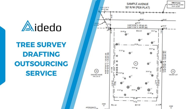
TREE SURVEY DRAFTING OUTSOURCING SERVICE
Many companies in the land surveying field have sought outsourcing services for tree survey drafting...
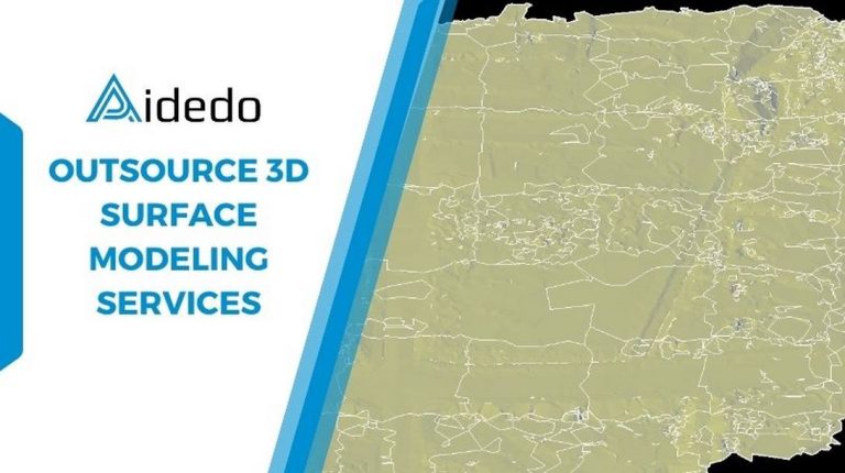
OUTSOURCING 3D SURFACE MODELING SERVICES
Outsourcing 3D surface modeling services are increasingly necessary in civil engineering and land surveying projects,...
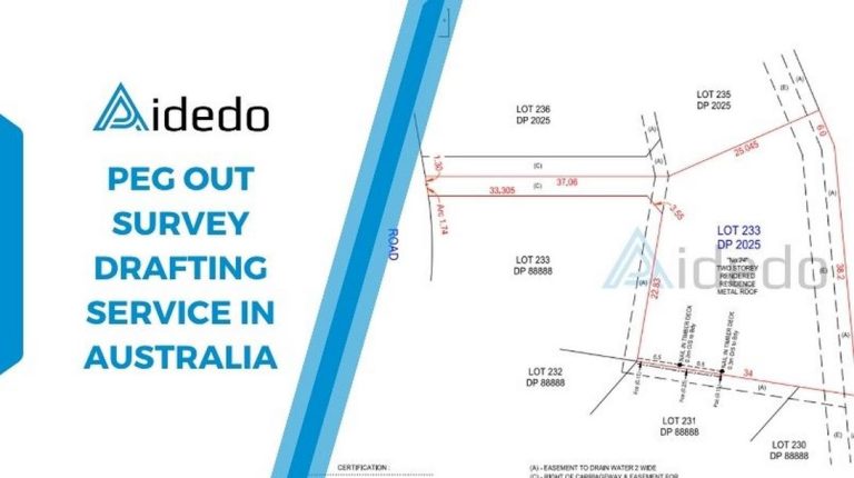
PEG OUT SURVEY DRAFTING SERVICE IN AUSTRALIA
Are you in need of a provider that can provide peg out survey drafting service...
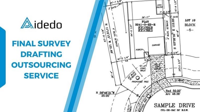
FINAL SURVEY DRAFTING OUTSOURCING SERVICE
Are you in urgent need of Final Survey Drafting Outsourcing Service for your clients to...
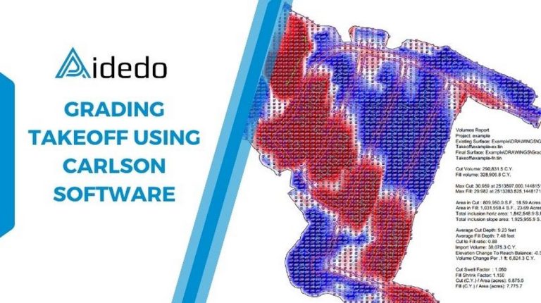
GRADING TAKEOFF USING CARLSON SOFTWARE
Grading takeoff using Carlson software is a solution that helps accurately quantify earthwork volumes, thereby...

Expert Civil Engineering Outsourcing Services in Vietnam
Are you currently using civil engineering outsourcing services for your company’s projects? Do you want...