1. What is a Plot plan (House Location plan)
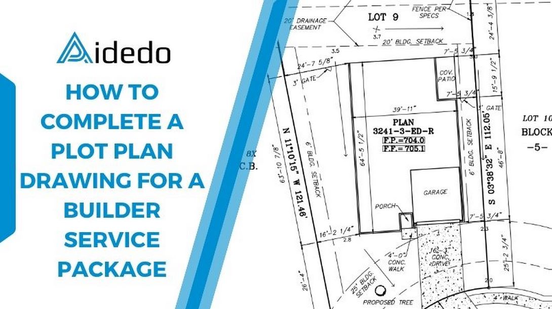
A Plot Plan is a 2D drawing that shows the footprint of the proposed building on a parcel of land, including distances to property lines, setbacks, easements, driveways, walkways, and other features. It ensures that the building complies with zoning and land use regulations.
In the Builder service package, the plot plan (also known as a house location plan) is often the first drawing to be prepared after the boundary survey and is followed by setback, foundation, form, final.
2. Step-by-step to complete a plot plan drawing
Step 1: Review Client provided data
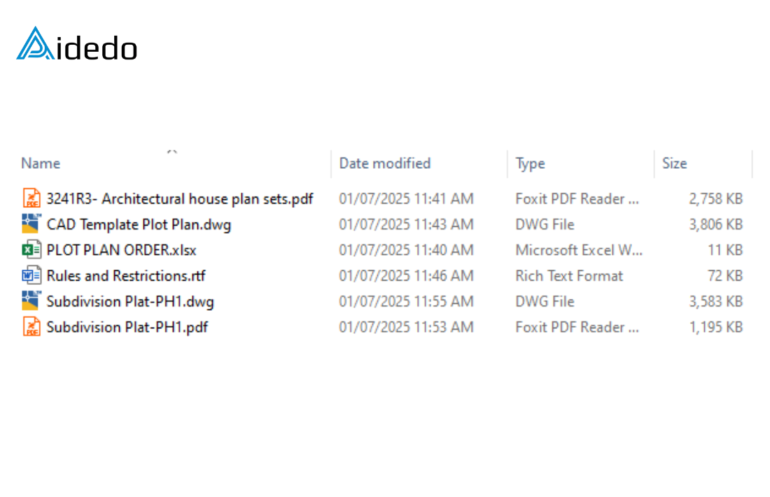
Before starting the drafting process, it’s essential to thoroughly check the documents submitted by the client. The typical package includes the following key items:
- Subdivision Plat (DWG or PDF format): This provides the official lot layout and legal boundaries within the subdivision.
- Architectural house plan sets (DWG, DWF, or PDF): These show the footprint, elevations, and layout of the proposed structure, which will be used to position the house on the lot.
- Rules and Restrictions from client (PDF, DOCX, or RTF): These may contain HOA guidelines, building setbacks, easements, or architectural controls that must be respected.
- Plot plan order information (PDF, XLSX, DOCX, or RTF): Includes community name, series, lot, block number, address, plan, elevation, garage information.
- CAD template for Plot Plan (DWG format): The standardized file we use to draft the Plot Plan according to the company or jurisdiction’s requirements.
Read more: plot plan survey drafting service
Step 2: Carefully Review Client Documents to Confirm Lot Details
Thoroughly analyze the client’s submitted materials to accurately identify the following:
- Lot and Block Number: Cross-reference the Subdivision Plat with the order form to ensure working on the correct lot and block.
- Property Address: Make sure the address is correct. Sometimes it appears differently in the documents, so double-check to be sure.
- Selected Architectural Floor Plan: Go through the architectural drawings carefully to find out which house plan the client chose. Architects usually give several options, so it’s important to use the one the client actually picked.
Step 3: Extract and Prepare Subdivision Data
Copy the data from the subdivision CAD file and paste it into template drawing using original coordinates. From the lot’s property line, offset 30 feet in all directions and keep only the data within this area.
Then, convert all elements to match the client’s CAD standards, this includes layers, linetypes, colors, text height, and any other formatting required.
Step 4: Redraw the Building Outline
Redraw the outline of the building exactly as shown in the selected architectural plan.
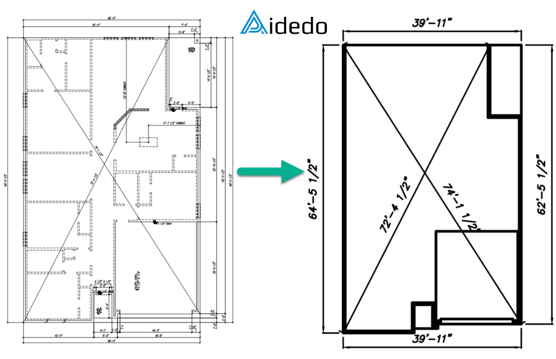
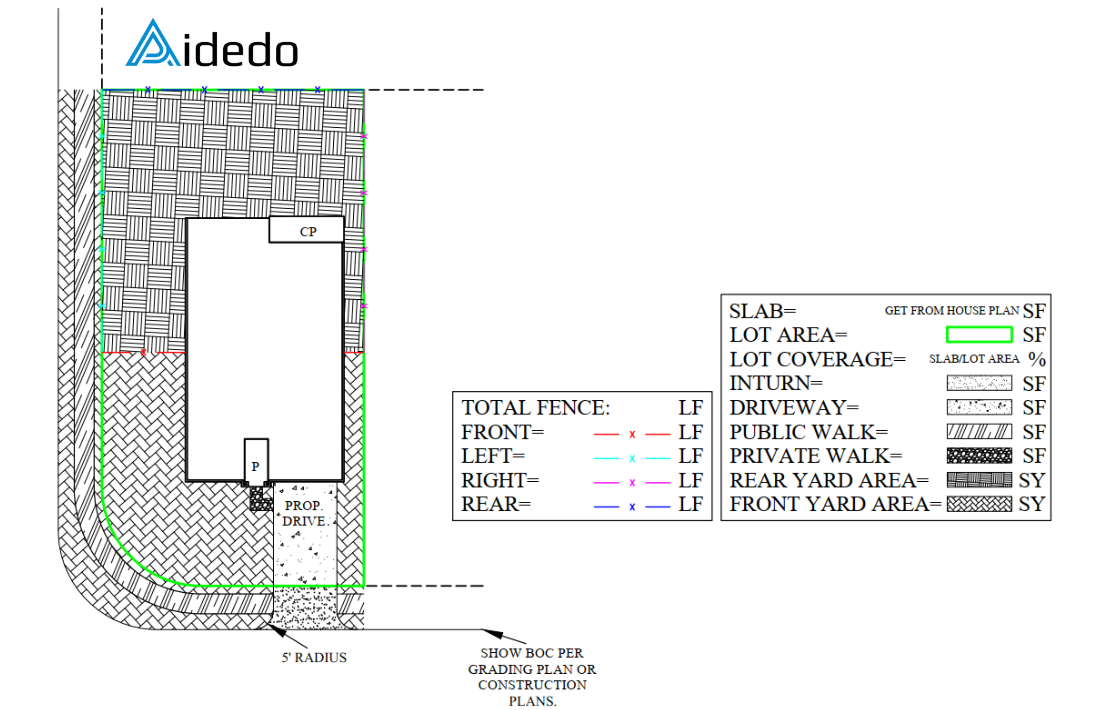
Additionally, draft all required site features in their correct locations, including private walks, A/C pads, driveways, and any other elements per the client’s House Plan Specs. Calculate and label the area and length for each item as needed.
Read more: land survey drafting outsourcing services
Step 5: Position the house and add required labels
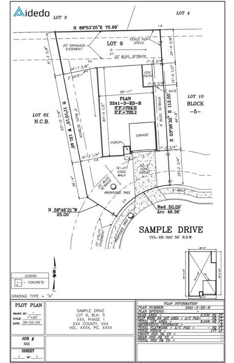
Based on the Rules and Restrictions provided by the client, place the house in the correct location on the lot. Next, label all required information, such as: FP, FF, Plan information, Bearings & distances, Setbacks, Easements, Driveway hatch pattern and any other details as specified by the client. Finally, review, print, and deliver the completed plot plan to the client..
To schedule a one-on-one consultation with our survey drafting experts, please contact us at contact@aidedo.com or complete the form below.
We are committed to delivering precise, efficient, and timely solutions tailored to your project needs.

