Land surveying is the technique, profession, and science of accurately determining the terrestrial or three-dimensional position of points and the distances and angles between them, commonly practiced by licensed surveyors, and members of various building professions. These points are usually on the surface of the Earth, and they are often used to establish land maps and boundaries for ownership, locations (building corners, surface location of subsurface features) or other governmentally required or Aidedo law purposes (property sales).
Land surveying is the detailed study or inspection, as by gathering information through observations, measurements in the field, questionnaires, or research of legal instruments, and data analysis in the support of planning, designing, and establishing of property boundaries.
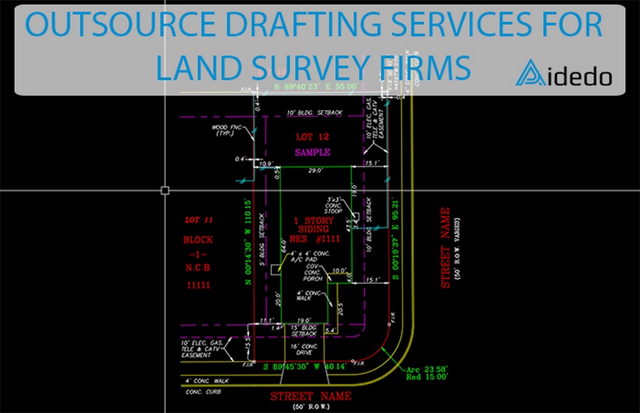
All land surveying companies need drafting members to produce drawings that show the gathered information from surveyors. However, you can just opt to outsource drafting tasks to Land Survey Drafting services.
As a Land Survey Drafting services Provider with 5 years of experience, we have done thousands of jobs from Residential, Commercial, Subdivision, Industrial to Golf courses for surveying firms in US, Australia, UK, Canada, …
We are a leading provider of a full array of cost-effective land survey drafting services to clients from across industries and of all sizes.
Our land survey drafting services include:
Plot Plans / Site Plans Surveys
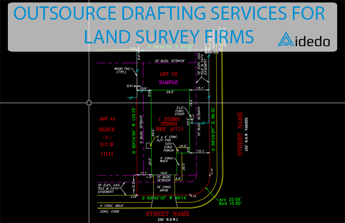
The plot plan is an architecture and engineering map which shows the size and configuration of the property. Plot plans indicate the desired physical changes and what is currently exists on the property. Location of the building, porches, decks, sheds, and landscaping features are some of the information that is included in the plot plan.
Final Surveys
The final survey is a boundary survey with all improvements to the property shown on the plan. The survey is executed after construction on the site is completed. The final survey reflects the visible improvements made during the construction process.
Stake Out Surveys
A stake out survey is the process of interpreting construction plans and marking the location of proposed new structures such as roads or buildings. The survey specifies the location of designed improvements by driving wooden stakes in the ground.
Forms/ Foundation Surveys
A form or foundation survey is performed to show the location in respect to the property lines, known easements, and known setback lines. By obtaining a form survey the location of the foundation is checked prior to the placement of concrete, and can save costly corrective measures in case of an encroachment of a property line.
As Built Survey
As-Built (or Final As-Built) survey is performed after completing any proposed construction and it precisely details the location of facilities and infrastructure against an original plan. An As-Built Survey (or Improvement Survey) is performed to detail the horizontal and vertical positions of the physical improvements of all or part of a tract, parcel or lot of land. This survey is required by a seller, buyer, lender and title company, for loan and title closing purposes.
Boundary Survey
Boundary (or Vacant Lot) survey is performed on a parcel of land to formally locate its corners and establish the boundary. The Boundary Survey, along with a mapping of the land boundary lines, details the corner markings relative to its adjacent surroundings.
Building Envelope Survey
Topographic Survey
Tree Survey
Commercial ALTA/NSPS Survey
Easement Survey
TABC Survey
Why outsourcing your work to Aidedo would be a good idea?
|
|
|
|
Are you considering outsourcing land survey drafting services? Just send us an email at contact@aidedo.com or you can fill out our online form below and we will contact you right away.
Please fill out the form below and let us know how we can serve you. Thank you!

